San Juan River Forecast to Crest at 19 Feet in Colorado
Heavy rains have triggered mandatory evacuations across Arizona and Colorado, with officials warning of historic flood levels in the Rockies.
By Sophie Zhang ·
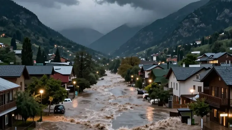
The San Juan River is expected to reach a height of 19 feet in southwestern Colorado late Sunday.
This forecast for the river near Pagosa Springs exceeds the 17.8 feet recorded during the destructive 1911 flood. Officials in the town, which is situated in the Rocky Mountains near ski resorts, issued warnings for potentially catastrophic flooding. The Archuleta County Sheriff's Office stated that extensive damage is expected as the water level rises.
Heavy rainfall has impacted a wide area of the Southwest since Saturday evening. The National Weather Service predicts that up to 4 inches of rain could fall in the region through Monday. This precipitation is fueled by a series of Pacific storm systems. The weather service issued flood watches for nearly all of Arizona, parts of southern Utah, southwestern Colorado, western New Mexico, and southern Nevada. This area includes the Four Corners region where these four states meet.
In Sedona, Arizona, authorities ordered residents living near Oak Creek to evacuate immediately. Flood waters were rising rapidly, trapping multiple people in their homes. Officials in nearby Camp Verde also issued evacuation orders for residents near the Verde River, West Clear Creek, and Wet Beaver Creek. Aaron Hardin, a meteorologist with the National Weather Service in Tucson, described the conditions as two or three months of rain falling in a couple of days. He noted that these conditions have caused flash floods, possible river flooding, and swift boat rescues in Tucson, located 230 miles south of Sedona.
Pagosa Springs officials instructed anyone in low-lying areas along the San Juan, Rio Blanco, Navajo, and Piedra Rivers to go to a designated shelter at a local church. Town officials said residents should leave immediately and not wait, as emergency crews may be limited during the worst of the storm. The highway entering the town was shut down to inbound traffic on Sunday afternoon.
In Sedona, residents in affected areas were directed to Sedona Red Rock High School. Officials urged people to avoid driving across roads with rushing waters and to stay away from creek beds and washes. Ed Mezulis, Chief of the Sedona Fire District, said in a Facebook video that emergency crews from surrounding communities were arriving to assist. He noted that local fire and police officials were already responding to multiple reports of residents trapped in their homes.
Mezulis advised residents to stay on high ground, watch their alerts, and exercise caution. The fire department shared a video showing powerful flood waters inundating vehicles and rushing past homes. Other social media posts included photos and videos of people standing on a pedestrian bridge, capturing the churning brown waters rushing underneath.
The latest round of soaking rains started Saturday evening. The weather service expects the rain to bring flash flooding to already saturated areas through Monday. The forecast calls for as much as 4 inches of rain across the region.
Source: Stamford Advocate